Cape Town’s dry winter arrived in an odd order: a violent, generous May, and then weeks of quiet, warm weather while a strong El Niño builds in the Pacific. The dams are full. The season is not finished with us.
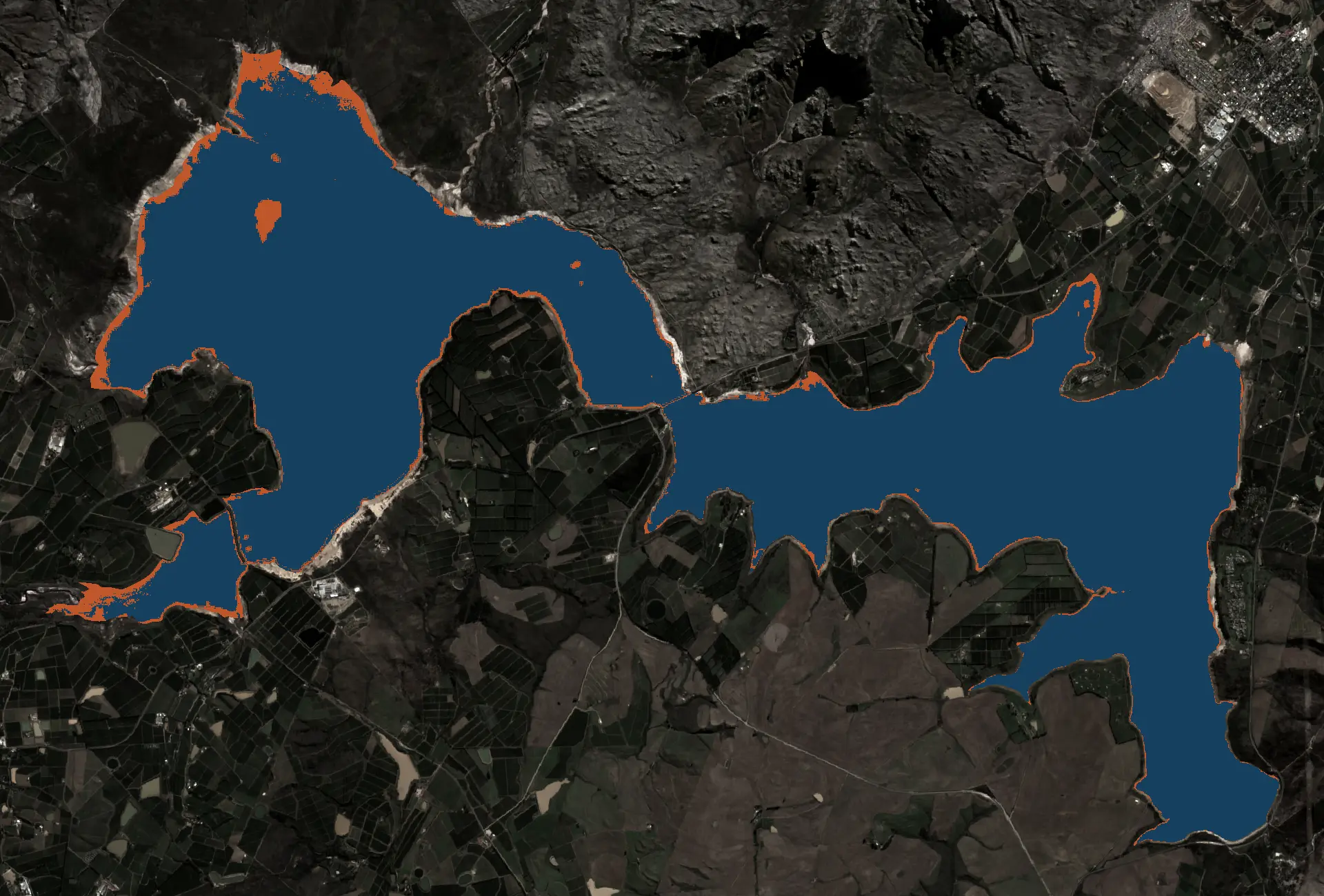
It is mid-July, the wettest month of the Cape’s year, and the hillsides above the winelands are flowering as if it were September. The sky is bright. The forecast is dry. Walk a farm in the Swartland this week and the talk is not about the dams, which are fine. It is about the summer.
That unease has a reason behind it, though not the one you keep hearing.
The story doing the rounds is that El Niño has arrived and switched off the rain. Half of that is true. An El Niño is running, and it is strong. The other half, that it dried out our winter, is where the science pulls the other way.
The winter that came early, then went quiet
Between 4 and 18 May, the combined storage of Cape Town’s six dams climbed from 47.9 to 69.4 percent. Twenty-one and a half percentage points in a fortnight, the kind of gain the system normally takes a whole winter to make. Cut-off lows stalled over the mountains and dropped a season’s worth of rain in a stretch of days.
Then the tap closed. Through July the catchments have had about 9 mm of rain against a long-run July average near 88 mm, roughly a tenth of normal, and the seven-day outlook stays dry.
So Cape Town dam levels in 2026 read healthy, 78 percent on 13 July against 82 percent the same week last year, while the rain gauge reads like a drought. A wet bank account, a dry month. Both numbers are real, and they are telling you about different things.
What the flowers and the farmers are reading
Early flowering is easy to over-read. Plenty of Cape plants bloom through winter by design, and the famous West Coast displays still peak in August and September. A warm, dry July nudges some of them forward. It is a signal about the last few weeks of weather, not a verdict on the year.
The farmers are reading something firmer. Dryland grain in the Swartland and the Overberg lives on winter rain, and a wet May followed by a dry, warm midwinter is an awkward hand: enough to get a crop up, then not enough to carry it. Western Cape rainfall that front-loads and then stops is harder to farm than a steady, ordinary winter.
What sits under both worries is heat. The South African Weather Service’s Seasonal Climate Watch leans below-normal on rainfall for the southwestern Cape through the back half of winter, and above-normal on temperature almost everywhere. Warm air pulls water out of soil, plants and dams faster. That is the thread running from the flowering hillside to the farmer’s forecast.
Is this El Niño? Yes, but not in the way it feels
An El Niño is real and it is here. The US Climate Prediction Center has an El Niño Advisory in effect, the Niño 3.4 patch of the equatorial Pacific was running about 2.1°C above average on 20 July, and forecasters expect it to strengthen, with a real chance of a very strong event by spring. On the global scale, that is a big deal.
For Cape Town’s winter rain, it is a small one. The dams fill on cold fronts off the Southern Ocean, and those fronts answer to the position of the South Atlantic high and the track of the westerlies, not to Pacific temperatures. The El Niño story running through South Africa’s 2026 headlines is loud, but its link to the Cape’s winter is weak enough that a 2012 study of hundreds of rain gauges found El Niño conditions have tilted the southwestern Cape’s May-to-July rainfall slightly wetter, not drier, since the late 1970s.
So the May storms were not Pacific weather, and the quiet since is not the Pacific switching off a hose. If you want the mechanics, the El Niño and Cape Town explainer walks through why the Pacific is background here, not forecast. The 2026 season tracker follows the dam numbers week by week. The same quiet shows up on the peaks, and what this year’s Western Cape snowfall says about the winter is a useful cross-check on the rain.
Where El Niño actually bites: the summer ahead
Cape Town collects water in winter and spends it in summer, and the spending season is where El Niño has form. A strong El Niño summer runs hot and dry across South Africa’s summer-rainfall interior; the 2015-16 event cut the national maize crop by roughly a third and stressed water systems across the country. This one is forecast to peak in spring, just as the Cape’s dry season opens.
That is the farmer’s real worry, and it should be the city’s. A hotter summer means faster evaporation off the dams and thirstier gardens, so whatever level winter leaves behind drains more steeply. The Cape Town rainfall by month breakdown shows how little arrives between November and March. The water in the bank by October is, in practice, the budget for the year.
What a full dam does and doesn’t promise
Seventy-eight percent in mid-July is a good place to stand. It is not a guarantee. Combined storage entered May 2014 at 72 percent; three winters of poor rain later it was near 21, and the city was counting down to Day Zero. The 13.5 percent shut-off line from those years is still the system’s working definition of failure, and the Day Zero predictor still runs a thousand simulated years against it.
The May storms bought Cape Town a comfortable winter. They did not buy next winter, or a cool summer, or a Pacific that behaves.
The numbers worth watching from here are simple. Each month’s catchment rainfall against its long-run average, on the combined dam levels page. Whether storage crosses 80 percent before the fronts stop coming. And how hard the summer pulls on what is left. Cape Town’s dry winter is not the emergency. It is the dress rehearsal for the one El Niño is more likely to bring, for now, after the rains have gone.